ANNUAL REPORT OF THE ARCHAEOLOGICAL SURVERY OF INDIA 31st MARCH 1912
{aridoc engine=”pdfjs” width=”570″ height=”600″}images/Doc/NEW/22184.pdf{/aridoc}
ANNUAL REPORT OF THE ARCHAEOLOGICAL SURVERY OF INDIA 31st MARCH 1912
{aridoc engine=”pdfjs” width=”570″ height=”600″}images/Doc/NEW/22184.pdf{/aridoc}
ANNUAL REPORT OF THE ARCHAEOLOGICAL SURVERY OF INDIA 1934-35
{aridoc engine=”pdfjs” width=”570″ height=”600″}images/Doc/NEW/ARASI_1934-35.pdf{/aridoc}
Thirty Years of Archaeological Surveys and Excavations in Sindh and Las Bela (Balochistan)
{aridoc engine=”pdfjs” width=”570″ height=”600″}images/Doc/NEW/Biagi_2018_-_Thirty_Years_of_Archa.pdf{/aridoc}
From Indus Valley civilization to My Home A story of Rehabilitation By:-Deepak Ramchandani ,
{aridoc engine=”pdfjs” width=”570″ height=”600″}images/Doc/NEW/From_Indus_Valley_civilization_to_My_Home___A_story_of_Rehabilitation_-_Deepak_Ramchandani_2179.pdf{/aridoc}
ANCIENT WORLD: PART ONE- EASTERN HELLENISM AND RELATED SUBJECTS
{aridoc engine=”pdfjs” width=”570″ height=”600″}images/Doc/NEW/AncientWorldLibraryPt1.pdf{/aridoc}
Some Old Sites in Sind By M.B Pithawalla 1938
{aridoc engine=”pdfjs” width=”570″ height=”600″}images/Doc/some_old_sites_in_sind.pdf{/aridoc}
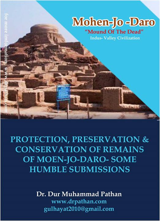
PROTECTION, PRESERVATION & CONSERVATION OF REMAINS OF MOEN-JO-DARO- SOME HUMBLE SUBMISSIONS
It was in August 1848, when Commissioner in Sindh, in compliance to Government of Bombay’s directive No.2803, dated 31st July 1848, asked collectors in Sindh, to furnish information relative to caves, monuments and archaeological sites in thin their districts.(1) It was the first time in the history of Sindh that Government took initiate for taking care of cultural property. Now it is in 2011, that Sindh Government and its Culture Department has started playing its install role for the protection, preservation & conservation of our glorious past that is available with us in the shape of Archaeological sites.
Though, still as the mystery, but a lot of material has been produced by scholars and archaeologists on the origin, cultures, down fall, preservation & conservation of Mohen-Jo-Daro. (2) origion and and end of Mohen-Jo-Daro, is still fabricated on hypothesizes. Its culture is being interpreted by conducting research basis of archaeological evidences, and preservation of its structural remains has been and is being recommended on solid technical grounds.
No doubt, it is remarkable work, but still more authentic and commendable work is needed. Now the Culture Department is looking after the ignored Cultural property, and we hope for the better results. The Department, under the dynamic leadership of the minister and hard work of capable able Secretary, has started materializing its responsibilities and Conducting/ Organising of this Seminar is a clear example of the seriousness, sincerity and devotion of the Department and its officials.
I am neither authority on the Archaeology nor a technical hand; I am a lay man, but with love and affection for my glorious Past and its archaeological and historical evidences. Moen-Jo-Daro is situated at the distance of a few mile from my village, therefore it is but natural to have attachment with the site.
After the Separation of Sindh from Bombay Presidency, Sindh Historical Society, wrote and requested the Director- General of Archaeology, that objects and Items are being shifted and that process may kindly be stopped and shifted material be handed over to Sindh Government.(3)The Director General replied. “The dacoity prevailing in the neighbourhood of Mohen-jo-Daro has prevented the exhibition there of objects of intrinsic value.”(4)
It is amazing to note that yesterday, there was problem of preservation of objects of the site, and today we are thinking about the preservation and conservation of structural remains. Now, it is a great and noble task for the Culture Department and I hope, the task will be completed as per requirements of the site and aspiration of the people.
I have gone through some technical reports, and most of them are worth to be implemented(5). They are concerned with only one dimension of the problem, i.e structural remains. Where as, in my opinion, the problem is multi-dimensional. It ranges from under earth condition to above walls. It is related with reasons of collapse of the civilization, it is connected with the administrative setup, law & order situation, psychology of masses and society, and it is connected with technical treatment and requirements of the site.
Structural remains at the site are deteriorating at unacceptable high rate. The main reason for the situation, Identified by experts is the crystallization and hydration of mineral then ardite (Sodium Sulphate). It has been said that drainage and runoff water, ground water and condensation of moisture, heavy rains and unbearable heat are high-risks for structure remains at Moen-Jo-Daro.
For minimizing almost all kids high-risk and threats, all dimension of the problem are to be kept in mind. The problem requires dealing and treatment technically and non-technically in this connection, my submissions are as under:
1. Administrative Grip:
No doubt, with handover of archaeological has revised administrative strategy, and it has started bringing better results. We have to accept the fact that in past, due to absentee stake-holder ship in administration, the site and structural remains have suffered a lot. Now, the code of conduct for visitors is to be prepared and implemented accordingly. Surface collection of material and objects is to be people of nearer villagers is to be discouraged. Community participation in the shape of “local Advisory Committee is to be ensured accordingly.
2. Blocking the Way of Water:
Technical experts have declared drainage, runoff water and ground water as high-risk for the Structural remains. If Aswan Dam can be redesigned to save the civilization, than why we cannot chain our Indus. Its course can be diverted. Everything is possible and nothing is beyond the vision, wisdom and sincere effort of devoted and dedicated Department or Government. If we cannot put Indus at arm’s distance, we can discourage its habit of supporting the rise of the underground water level. It is possible to build “protative boundary wall” right from under earth up to chest level. If chinees can built a well to protect themselves from invaders, we can also end the invasion of unserground water or inundation by Indus. The Government by baning the cultivation of Rice croop within limits, as to be recommended by experts and technicians can also minimize the underground water level to some extent.
3. Minimizing threat from visitors:
Very serious threat, that is being faced by structural remains at site, is under attitude of visitors. Walking on walls, jumping into wells, photography on sensitive spots and surface collection of valuable objects has become the culture of visitors. To curb tendency, administrative steps with Iron hand are to be very nmuch required. It is essential to raise the entry fee and watch activities of visitors through c.c.tv. system.
4. Cages & Conservatories for sensitive spots:
To save the very sensitive and important sports from visitors, cages and conservatories can be installed accordingly. Because it will save a lot. If animals in zoo can be protected by same method, why we cannot introduce I on the site.
5. Fiber glass cover to protect structure from heat & rain:
For protecting our evidences of glorious past form rain and heat, we can provide Fiber Glass ceiling to the portion/spot of site, unable to bear heat and rain more.
6. Making the task continuous & permanent:
Preservation, conservation and protectin of Moen-Jo-Daro, or any site of archaeological importance is not a one a “one time task.” It is a continuous prosess.
There was my passing reference, in the beginning. Talking about the dimensions of the problem with the past. Though it seems to be vauge, but it bears some weight. I am diverting and inviting attention of scholar and archeologists to a new aspect of the problem and subject. We can refer to past for our present problems and situation also.
On the rise and fall of Moen-Jo-Daro and Indus civilizations, at least five theories, let me say hypothesis have taken birth. They are:
a. Twisting and turning of Sindhu. (6)
b. Drought caused by damaging and making the Indus empty.(7)
c. Climate change. (8)
d. It was transformation. (9)
e. It was finished by atomic war fare. (10)
The reason what so ever be, but these hypothesis/theories have Identified Sindhu and climate responsible for the cause of fall of wonderful civilization.
Keeping these studies, theories and hypothesis in mind, I have linked one dimension of the problem of conservation and preservation of structural remains of Moen-Jo-Daro with the past. It is an agenda for archaeologists, anthropologists and social scientists to look into the matter and find if these are common factors of high-ricks and threats in past and present in this connection , I will also request and recommend the culture Department for establishing of the Reference library of international standard at site, having collection of source material, information, data on the site, Archaeology, comparative studies of vanished civilization etc.
I must not take more time, because I am here to listen and learn more from scholars, experts and archaeologists.
So, thank you all.
REFERENCES & NOTES:
See files No 215 , General 1848, commissioner’s old records, with special reference to letter No. 2803, dated 31st July 1848, from Govt. of Bombay to Commissioner in Sindh & circular letter No.2199 sated 12th August 1848, from commissioner- in Sindh to collectors of districts.
It is interesting to note that Sindhi Scholars have contributed a lot towards adding source material on Archaeological sites of Sindh. A few titles of their papers are given as under. Their writings are to that extent that a Bibliography on the source-material can be complied:
A. “Identifications of some old places in Ancient Sindh” (Journal of Sindh Historical Society,
Karachi, Vol-Part III, March 1935).
B. “Excavations of pre-Historical places in Sindh”,(J.S.H.S, Vol II, Part I, June 1936)
C. “Extracts relating to Sindh from Annual Bibliography of Indian Archaeology from 1926-1936’ (J.S.H.S, Vol II, Part I, August 1937 & Vol III, Part IV December 1938)
D. Index to Annual Archaeological reports for 1920 to 1929;” (J.S.H.S, Vol V, Part IV, Feb: 1942)
Photostat copy of the letter is attached here with as Appendix No-1
Photostat copy of the letter is attaché here with as Appendix No-2.
The Technical report by James R.clifton on “ preservation of structural remains” at Moen-Jo-Daro prepare in 1980 is one of these technical reports. It deals with the problem of reduction of the rate of brick deterioration. 13 + 3 pages report is a good task done by the author.
Earnest mackay who worked with Sir John Marshall believed that flooding of Indus river caused the destruction.
Another theory that has been proposed about abandonment of Moen-Jo-Daro is that Indus was impounded by formation of natural dam near sehwam which caused so much trouble dam for people of Moen-Jo-Daro that they abandoned it . this theory was proposed by Raikes and Dales.
Climate change theory was proposed by Prof. Gurdip Singh in 1971.
Possehl, Bridget and Raymond believe that it was transformation.
Philip Coppens is of opinion that it was Atom, Necular Warfare that had ended the wonderful Indus civilization.
Appendix No-1
Sindh Historical Society,
Karachi
Dated: 22.5.1945
To,
The Director-general of Archeology in India,
New Delhi.
Sir,
The members of the Council of Management of the Sind Historical Society view with conern the intention of the Archaeological Department to remove the valuable relics from the Museum at Mohen-Jo-Daro to Lahore. I have been asked by the Council to place before you their view on the matter and hope that the they will receive at your hands the consideration they merit.
The main reason for shifting the relics seems to be that since Mohan-Jo-Daro is an out of the way place, the relics are practically out of the reach of the average scholar. As such they need to be shifted to centrally situated station where accessibility to them is guaranteed to the research worker and the archaeologist. And Lahore appears to the Archaelogical Department as the mos suitable place for the purpose under the existing circumstance. The Council of Management fell that in this respect the claims of cities in Sind have been over looked while deciding the issue.
The Council is definitely of the opinion that Karachi is more suited for the puepose. Karachi is quite accessible and offers at least as much faciliyty to the scholar as Lahore does, if not more.
Karachi has a local Museum where the relics could be housed. That the relics would be safe and would be well looked after is certain since Victoria Museum at Karachi is in charge of an archaeologist Mr. Roy, who has himself worked at Mohan-Jo-Daro. The council of Management are glad to inform you that the Victoria Museum Authorities had plans ready for the construction of a separate Mohen-Jo-Daro wing, but as the war broke out the plans could not be executed, but now that the hostilities have ended in Europe , the authorities are seriously contemplating he construction of the afore-said wing at the earliest possible moment. Karachi thus offers the best accommodation and care for the relics.
At the same time Karachi enjoys an equable climate which will make it possible for the scholar to study there all the year round, where as in Lahore it will be extremely difficult for them to work during the hot weather.
The Council of Management are of the definite opinion that Sind has a better and a prior claim to house the relics of a civilization that is its glorious heritage. In addition, if the Mohen-Jo-Daro relics are removed outside Sind, the scholar will finds from the various chalcolithic sites in Sind, many of which have been but partially excavated by the late Mr. N.G.Majumdar and are likely to receive more attention at the hands of the archaeological Department in the near future as the hold out much promise.
Bearing all these facts in mind, the Council of Management feel that in case the Archaeolgical Department do want to remove the important relics from Mohan-Jo-Daro, the Karachi Museum should demand their attention first, particularly now, as it has never received the attention it rightly deserves. The Council further venture to suggest that are presentative collection of Harappa culture finds may also be sent to Karachi to make comparative study possible.
It, however, occurs to the Council that the claims of the Karachi Museum may be waived on account of its management being in the hands of the local Municipal Corporation. This objection, the council feel can be set at rest by the appointment of a local select superintending committee of official and non-offficial experts to safeguard the interests.
The Council of Management of the Sind Historical Society are sanguine that if the matter of removal of relics from Mohan-Jo-Daro is considered in light of the above facts as also the starting of the Sind University which contemplates the starting of the Department for the study of Sind Culture at the very commencement of its career, your Department would agree to the suggestions made by them.
Your faithfully
sd/ N.M.Billimoria.
Vice President, Sind Historical Society.
Appendix No-2
From: Dr. R.E. Mortimer wheeler,
Director General of Archaeology in India.
Simla, the 24th July , 1945.
Dear Sir,
With regard to the subject of your letter of the 22nd May, 1945, namely, the removal of relice from the MohenJoDaro Museum a communication has been sent to the Government of Sind. I am therefore now able reply to your letter written on behalf of the Sind Historical Society.
The press reports and rumours relating to this matter were much exaggerated, and the correct facts are as follows:-
1. For some years the dacoity prevailing in the neighborhood of Mohenjodaro has prevented the exhibition there of objects of intrinsic value. These objects have therefore been stored in a bank safe some miles away.
2. Very few visitors, particularly at the present time, are able to visit Mohenjodaro, although it is clear from enquiries received that interest in the site and relics is maintained.
3. It is to be hoped that in due course an adequately financed and maintained museum may come into being at Karachi. The present museum , however, cannot be so described. I made a special point of visiting the Victoria Museum at Karachi in 1944 and found it in an extremely unsatisfactory condition. the object were arranged unsystematically, there was a great deal of dirt in the cases, and there was a complete absence of systematic labeling. It is obviously not for me to diagnose the causes underlying this state of affairs, but I was compelled to make it clear to the Curator that, unless the situation should materially improve before my next visit, I should be compelled to withdraw the loan collection of Mohejodaro relics now deposit there.
4. On the other hand, at Lahore there is an adequately (though not lavishly) financed provincial Museum which was prepared to give adequate space for an “Indus Culture” exhibition. Lahore itself lies approximately in the centre of the ancient Indus Valley area, and it is on one of the great modern traffic routes of India. The conditions are thus particularly suitable for the purpose in question.
5. At the same time I would make the following point clear to you:-
(a) The objects from Mohenjodaro now at Lahore are placed there only on loan and without prejudice to their future disposal.
(b) A considerable collection of objects will be retained at Mohenjodro itself so that the visitor may be in a position to appreciate the general characters of the Mohenjodaro culture.
(c) If and when a suitably maintained museum is established at Karachi with some sort of permanent guarantee behind it, my Department will be very glad indeed to cooperate fully with it in making it worthily representative of the province which it will serve.
Yours faithfully,
Director General.
The Vice President,
Sind Historical Society,
Marston Road, Karachi.
BRIEF INTRODUCTION
AMRI REMAINS
Brief History:
Near the small village of amri in dadu district on the western bank of Indus river and between laki hill rangesand the Indus river lie buried the remains of a pre-historic settlement which flourished in the Indus valley in the middle of the third millennium B.C
It was first discovered by Majumdar in 1929. The French Archaeological Mission, headed by Jen Casal with the active help of Department of Archaeology under took excavation from 1959 to 1962.
Of the three ancient mounds at Amri, the largest Mound “A” is forty four feet high from plain level. Mound “B” is situated about two under yards to the west of Mound “A” Mound “C” is north-west to Mound “B”. excavations at the top of Mound “A” revealed the Muslim occupation. Below the Muslim period settlement the excavation exposed the remains of the period the remains of the period known as ‘Late Harappan’ and below this the remains of ‘Mature Harappan’ and at the virgin soil the remains of ‘Amri period’ were exposed.
BAKHAR FORT
Brief History:
Planted in mid stream between sukkur and Rohri, Is a chain of islands, the largest of which is Bakhar once a forti-fried strong hold and the and quarters of a petty covered now with dismantled and forlrn ruins, acroos which the railway runs between the two sections of the lands down the bridge. It is a lime stone rock eith hundred yards from east to west, three hundred wide about twenty five feet high. The walls of the fort which were double rose to a height of thirty or thirty five feet and were strengthened with numerous bastions. There were two gate ways, one facing Rohri and the toher sukkur. It was at one time occupied by British troops after which it was converted into a jail. In thufat-ul-kiran it is mentioned that this town did not exit in the time of Hinhju Raj and that it got its name Bakhar (the dawn) from syed Muhammad Maki of religious memory who uttered this word on his entry in to the town early in the morning some years after its foundation. In the ain-i-akbari we are told Bakhar is a good fort.
At the time of the arrival of the imperor Humayun, Muhammad Khan built an other enveloping wall to the fort increasing its circuit to 1875 years with four gates opposite these in the inner wall and with 70 bastions. The fortifications were rebuilt and restored for the last time by the governor Nawab Ghulam Sadique Khan about 1780-90 in the region of Taimur shah to whom Bakhar then belonged. Bakhar is one of the few pretty sports on the Indus in its course through sindh.
Under the Kalhora the district of Bakhar is mentioned simply as a Taluka or perry sub-division. The fort then passed into the hands of Mirs of Khairpur from whom it was taken over by the Biritsh Government under an agreement in 1842 A.D
BIRTH PLACE OF AKBER THE GREAT
Brief History:
Akber the great, the son of humeyun and his consort hemida bano, who was destined tobecome the most illustios monarch of his time was born at this place on 23rd novembner, 1542 A.D. it was time when humayun after being routed by Sher khan, afghani governor of Bihar tock regure at this place along with his wife and army. Rana parashad sodha gave hism shelter in his fort. The un crowned king celebrated this auspicious occation by simply distributing “Mushk” among his faith ful companions with these words. The fane of this new born baby would one day spread all over the world like this gragrance of this mushk. The can copy was built by Syed mehar shah of khehjrari on 1858 A.D. at that fact sport war where Akber the Great was born.
BUDHESER MOSQUE
Brief History
It is situated at budheser village near budheser water tank. It is about 49.8 ft long and 42.7 broad. It has small prayer chamber measuring and are 23.5 x 13.6 ft. the mosque has an open court yeard and has eight marble stone pillars over which dome of the mosque resting upon. It has four rounded cupolas on the roof and other than these tow more gupolas are together on the roof vfrom southern side. There are tow torrests on thcdorner of the mosque situated at the main façade.
Besides the mehrab, there is no any plat from for delivering the surmon, there is no any evidence of plat from where Imam could have delivering the sermon on Friday prayer. Therefore the mosque in question possesses unique architectural feature in the region.
The mosque was built in 1505 A.D by mahmood bin muzafar shah, the ruler of gujara. Near the mehrab, there is Persian inscription inscribed on the white marble, which is not now clear to read easily. There is grave of martyrs out side the court yard of the mosque. Who faught with sodhar rajput froim mahmood bind muzafar shah begra of gujrat in 1505 A.D at the site of Budhesar. the mosque was declared a protected monument under antiquities act, 1968
CHARO (RED) BHIRO OR MOUND BHIRO
Brief History
It is located on the south of Sher wah village and Shrine of Syed Muhammad Shah. The Bhiro village, is very close on its east directions, the “Seem Nullah” also lies on its south direction. It covers an area about 5 acres. It is generally known by local people as Gharo Bhiro, because the entire mound is covered with red power of burnt bricks and brick bats. It is also fortification, wall was built with burnt bricks having bastions at equal intervals. The high mound rises at the maximum highest about 10 feet from its surrounding level. There is series of small mounds but are separated from one another.
CHITORO GRAVE YARD
Brief History:
The chittori grave yard in district mirpurkhas is also a protected area under the antiquities act, 1975. The tombs in this graveyard are classified as monuments of category ‘C’ most of them are bult by talpur ruilers who ruled in province sindh generally and miorpurskhas in particularly. Among them mir sher Muhammad makani talpur ‘SHER-I-STUR’ was famous and brave is also buried here. He gfaught with “Frangi” ion the batgtkle of “DUBA” in march 1843 A.D the art of caruyomg amd cartopgraphy on stone is very charmjing and can be seen clralhy in large scakle uin different tombs of chittori grave yard. The department of archaeloghy has appointed two full time chwokidar to look after these tiombs and also carried out certain reoparis of those monuments which were badly affected bnyu last heavy rain.
It may be mentioned here thjat on area of 26 crores 4 ghuntas in favour of faqir sher Muhammad was deported vidce directofr of archaeology. Pakistan marshal’s letter no. 39/59/72-arch: dated 27th January 1977. In this area tow protected monuments i.e tomb of aulia pir gchittori badahah qureshi and other old ruined miosque were handed to faqir sher Muhammad. Now only 12 acres of progtectged area comprising the ancient monuments is in the possession of the deparment. At present 13 tombs and one mosqyue at chittori grave yard are looked after by the department./ te detail of these is given as under”
I. Bricks tomb of arzi khokhar
II. Tome of mir khan s/o karam khan talpur
III. Tombn of mir jado
IV. Tomb of mir muran khan
V. Tomb ofmir musa khan
VI. Tomb of mir rajo khan
VII. Tomb if sgageed jaoru
VIII. Tomb in the north west of no. vii (name not known)
IX. Stone tomb wast of no. ix above (name not know)
X. Stone tomb west of no ix
XI. Tomb of mir fateh khan and mir mirza khan
XII. Tombn klniown as of females of mir;s dynasty
XIII. Old structures of a tom and moswue
XIV. Tomb of auliar pri ghittori badshah qureshi deprotected
XV. Old ruined mosque
DHAMRAO DARO
BRIEF HISTORY:
It is a Buddhist site located about 6 KM from Badah town and 15KM from Moenjodaro in District Larkana. It consists on stupa and monasteries of Buddhist period. Three group of mound spreading from west to east and the middle one has stupa built on it. There is another separate mound located at a little distance and north of the three groups. The mound actually covers a total area of about 70 acres and about 30 foot high above the surrounding plan-level.
The imposing look of the mound with its height and dimensions suggest that it must have been great importance in its hey-days.
DASRAN JO BHIRO (MOUND OF DASRA)
BRIEF HISTORY:
The mound is located on the wast of shadi pali railway station and south of railway line ans shire of qabnool shah in deh khuda bux. It is harappan period site. It was fortified town flourished on the banjk of river rani, once it was the branch of river hakra, the remains of bed of thr river of reni are visible on the west of the mound. It covers an area about 7 acres, the high mound rises at the minimum height about 15 ft from its surroundings level,. It is locally called Dasran jo daro, because the town was capital of Dasra Dynasty earlier, than Ray Dynasty. It has been mentioned as “Bahror” by the author of Chach Nama. The fortification wall was built of burnt bricks hsving bastions st the different intervals, the evideince of the fortification wall are clearly visible.
GORI TEMPLE
BRIEF HISTORY:
The gori temple is located in nagaraparker taluka about 25 miles from nagarparklar town and about 4 miles from MArvi’s village bhalve (majir) perhaps it was built by mengho, a jainee of pario nagar (14 miles frolm nagarparkar) in 1376 A.D actually the followers of the jain religion were worshioping paris nath parsopoo nath whjo was the disciple of gru gorkh nath.
Paris nath was also familiar from goricho, therefore, after is name the temple become famour as gori temple.
The temple an belobng building measuring externally from north to sourhyt 74 ft in length and from east to west 49.6 ft in breathg, haeing a dwarf wall cour yard measuring 49.2×48.6ft. entrance to the mandaopa is obtained through a doomed piorch on the nortgh, which is eight pillerec can opy and on pillar supporiting to the cave or ghujja at four coprners some pillars are of marble stone and some ore of lime stone having palste red with lines. The sridhara piollars having stall shafts square below and circular above, clasped aorojund a interv als with girdles of delicate carrying and surmounted by an appropriate bracket capital. This can opy is connected through roof slab with the portal. Exterior slide of this can opy is embellished with paintings. It is covered with dome. From can opy there is a short passage supported with two dwarf pillars.
In the temple, there is a room vihana, the mre sacred chamber of whuch, the upper portion is called shikara. At present the shikar is noit surviving in fjull height, because the upper portion was demolished bu the oprfer of gol.tarwat, the commander of british goops djuring the battle faught between the rana sodha of oparkea and british army.
The parapet wall of the temope ghas been vanished only it surfives at the main façade and is deco0rated with pklaterin gpanels like merlion. The height of main façade wall up to cornice is 11 ft from floor level. The construction of the tompe is remarkable. The entire building was decorated with fresco painting.
HAZRAT KATIB SADRUDDIN MUHAMMAD
BRIEF HISTORY:
The saint Hazrat Khatib Sadruddin Muhammad was the son of Amir shah Mir Muhammad Maki Mashihadi. Who gave the name Bakhar to the town, which was before called farshta, his tomb is now located near Deputy Commissioner Office at sukkur. Hazrat Khatib Sadruddin Rizvi was born in 727 A.H. its grave is situated from northern side of lands down bride. No any tomb or canopy is erected over is gave, but a special chart shading the grave of the saind and the wooden gates of the Darah show a delicate work of wood carving.
JAIN TEMPLE AT VIRAWAH
BRIEF HISTORY:
It is located at virawah village abotu14 miles away from nagarparkar. It has lost its glory due to passage of time. Most of the paintings and sculptures have been defaced or taken awyay. Its parts of the structure are a mere jumble of stone. But it is qauire clear that this tem;ple was a finished example of the building art, its ashler mashonary is precise and ordely. The architectural treatment of the parts are stull ib position to show knowledge.
The temple consists of two riooms having a large hall called man dapa and an other a small dark chmber called vihana.
The mandaloa kf the temple erected on raised stone plat fropm hgas conskiderble dimension in rect singular 13.5 x 12.11. the hall has 12 plasters supporign to the dome of the hall. The walls of the hall or mandapa decorated with birds, animals and flower plants and a man driving on a small two wheeled carriage pulled by a horse, dancing coupe amd m,uisicians etc.
The vihala or dark room which is most aacred ploaced,. Where sculpture of the god might be placed and its devolees worshiping it. The room measuring 6.11 x 5.11. its oputer upper portion is covered with shaikhara ior tower which is crii from in shape.
JAIN TEMPLES AT BUDHESAR
BRIEF HISTORY:
There are three jain temples located at budheser village and near budhesar mosque. The construction work of the forst temple which is nearer to the mowue thatn others is remarkable, both the dressed stone and fine carved stone have been used in its construction. This temple has one sacctuary wuit a tall sikhara and accessible by a flight of 15 steps. Its raised plat from if abouit 10.4 ft high from the ground. The vihana room measures internally square in plan 7.10 side with a solid bench. The height of the room inside is 13.1 and covered with 29.3 tall sikhara.
The second temple lies on the foot of the karunjhar hill and on the south of the first temple. The temple building built iver a raised stone plat form with stone apron. The madapa hall is graced with 20 number pilklars and dovered with dome and along with tlnmall rounded cupolas. This colouned hall has a series of ce4lls facing all in wards. The roof of this temple gives a picturesque look due to rounded cupolas.
The third templke lies oin the eastern side of the second temple. It hss a small single room with an open verandah. The roof the verandah might have beel collapsed. The temple building has fenced with one big dome at the centre and two sided small domes fiorming the roof.
JAMIA MASJID KHUDABAD
BRIEF HISTORY:
Jamia Masjid Khudabad situated in the beast corner of Kalhora village. Khudaabad in District Dadu was the capital of Kalhora rulers. The city was established by Khuda Yar Khan Kalhoro. Kalhora were the religious minded and thy desired to construct beautiful buildings, mosuques and etc. it is a very big mosque of that period. About 5000 peoples can offer their worship at a time. The mosque occupied 36 Ghunta of Land. The various colour painting work and Kashi style bricks are used in front and interior side of the mosque to make it beautiful and attractive. During the pruiodd of Mian Ghulam Shah Kalhora, the capital was changed to the presend city of Hyderqabad. After changing the capital, the importance of this mosque (House of Allah slowly reduced but every passer by get good feelings from it construction.)
JHUKAR MIUND
BRIEF HISTORY:
it lies about 10 K.M north west of Larkana and just close to village Mitho Dero. The mounds at Jhukar have a great Archaeological and historical importance. They have yielded remains from the period of Moen-jo-Daro down to the 6thCentuary A.D these mounds however, are not so extensive as monejodaro. The ckity barried under these mounds appear to be of much loss importance in the pre-historic times than the moenjodaro was.
The site was visited early in 1928 by Mr: N.G.Majundar who commenced a tentative investigation ofr the two monds situated here. These preliminary investigation yielded pottery and other objects belonging to servarl cultures. In the lower levels remains characteristics of the Harappa period were found but above them the other building together with a new kind of pottery which Majumdar termed as late Jhukar. Still higher up the mound, evidence of third culture the indo-assanians first came to light. From the third trench Majumdaar was able to excavated a hoard of 250 coins some of which belong to Kushan king vasudeva and his succesors while the other bolong to bearing cupta characters of the 5th centuary A.D. and a unique seal with Pahlavi.
JHUKAR MOUND
BRIEF HISTORY:
It lies about 10 K.M North West of Larkana and just close to village Mitho Dero. The mounds at Jhukar have a great Archaeological and historical importance. They have yielded remains from the period of Moen-jo-Daro down to the 6th Centaury A.D these mounds however, are not so extensive as monejodaro. The city barried under these mounds appear to be of much loss importance in the pre-historic times than the moenjodaro was.
The site was visited early in 1928 by Mr: N.G.Majundar who commenced a tentative investigation for the two monds situated here. These preliminary investigation yielded pottery and other objects belonging to servarl cultures. In the lower levels remains characteristics of the Harappa period were found but above them the other building together with a new kind of pottery which Majumdar termed as late Jhukar. Still higher up the mound, evidence of third culture the indo-assanians first came to light. From the third trench Majumdaar was able to excavated a hoard of 250 coins some of which belong to Kushan king vasudeva and his successors while the other belong to bearing cupta characters of the 5th centaury A.D. and a unique seal with Pahlavi.
KAHUJ O DARO / MIAN BUDHIST STUPA
BRIEF HISTORY:
The khuhadaro mound is an important historical and archaeological Budhist site dating background about 2500 years old. It is located about one kile moeter away from north of the present city iof mirpurkhas and just close to mirpurkhas nawab shah railway line,. The site can be divided into two parts one is called “kahujodaro” it self and other part is known is ’budhist saupa’
The site was first excavated in 1909 A.D by henry consins, superintendent of archaeology department , who has mentioned its detailed report, in his book ‘Antiquites of sindh’ . during excavation, a budhist. The other material recovered during excavation is now diaplayed in Bombay museum in India.
Keeping in view of tits importanct the department of archaeology has declared it as protected site under antiquites act, 1975./ according the said act, any un-authorised digging, encroachment or other such sort of activity is prohibited within protected area..
KOT DIJI FORT AND KOT DIJI REMAINS
BRIEF HISTORY:
Kot Diji fort, once a strong hold of a member of Talpur ruling ramilies, spreading over an area of about 3 KM is situated 15 miles south of khair pur town and north of kot diji village, on the national high way.
It is 5 shaped and lies prominent on a range of low lime stone hills proceeding in a direction from south east to north west and reaching the Indus at rohri. It was built by Mir sohrab khan talpur several hundred year back and still retains it grandeur. The entire fort has been built of burnt bricks where as at intervals rohri stone has been used some cannons of those days have boon removed and placed at importance buildings and main thorough fares of khairpur.
The kot diji fort consists of a number of fortification crowning several eminences and connected by a single mud wall pierced with loop holes. Here in January 1843 the British army was encamped during the advance of sir Charles Napier to destroy the fort of imamgarh located on the border if sindh and jaisalmir in the desert area.
Under the shadow of medieval diji for there is pre-historic site of kot diji about 5000 year old which was first excavated in 1955-57 by Dr: F.A khan former, director Department of archaeology and museums. A wall built with soil and stones had also been found around it, which at one time was so wide that a bullock-cart could easily pass over it.
Lohim Jo Daro
BRIEF HISTORY:
It is located about 350 meters in the north of Piaro Goth station in Dadu district on the bank of old river, it was excavated by Majamdar and he revealed its two periods, one was related with Harappan period and later was related with post Harappan or Jhankhar period. Lambricks views are that after the destruction of moenjodaro. The inhabitants migrated and settled at Jhikkar, Lohum jo daro and chanho jo Daro.
Many objects during excavation have been found for example pottery. Toys bangles, stone beads and seals etc. these objects also resemble with the objects of moenjodaro.
MIR MASUM’S MINAR AND TOMB
BRIEF HISTORY:
Mir Masum Shah Bukhari was the Nawab of Bakhar region during Akber the Great reime. He created many monuments in Bakhar and Sukkur, among them Mir Masum’s Minar is famous one. It is located in the centre of the Sukkur city. It’s construction work was commenced in 1593 A.D, but completed after 14 years by Masum’s son. The minar its self is about 100 feet high from eastern side. The minar is made of un-glazed red bricks alternating with light blue filling in the joints, providing a conspicuous note of colour. The inner side of the small dome on the top of the minar is decorated with glazed tilws which from floral-cum-geometrical designs.
While the tomb located near the minar is made of un-glazed red bricks alternatking with light blue filling in the joints. The walls are decorated with glazed tiles making floral cum-geometrical designs. The vesco work on dime is well done. There is stair case leading up to the gallery already made in the inner side of the tomb. The outer face of the dome is also with glazed tiles making floral cum-geometrical designs. The vesco work on dime is well done. There is stair case leading up to the gallery already made in the inner side of the tomb. The outer face of the dome is also decorated with the glazed tiles. The monument in a question was also built by Mir Masum Bakhri, whose grave is just near the tomb. The tomb is locally known as ‘Fiaz Majal’ which was used by its builder for meeting/sitting purpose, because there is no any grave made inside the tomb.
MIRAN-JO-TOWER OR DHAMRAHO SQUARE TOPWER
BRIEF HISTORY:
The tower known as a miran jo tower by local people is situated from north-east and at the distance of about 15 K.M from taluka and district Head quarter, Larkana and about 2 K.M from the village Dhamraho. Actually there was no any use to construct such type of towers during the Mir’s period to Jhukar mound and other Buddhist sites spreaded in districts Jacobabad and Sibi Baluchistan. It is concluded that the square tower might be the tower of Ashoka the great period and was used as watch tower in kalhoras period. Shah Baharo was the governor of Larkana region. In that time Borhi of Balouchistan made so many attacks in the leader ship of Abdullah Khan Brohi to Larkana through the same route. In that attack Rato Jalbani, the founder of Ratodero was killed but shah Baharo the governor defended Larkana in good way and saved his jurisdiction at all.
MIRAN-JO-TOWER OR DHAMRAHO SQUARE TOPWER
BRIEF HISTORY:
The tower known as a miran jo tower by local people is situated from north-east and at the distance of about 15 K.M from taluka and district Head quarter, Larkana and about 2 K.M from the village Dhamraho. Actually there was no any use to construct such type ot towers during the Mir’s period to KJhukar mound and other Buddist sites spreded in districts Jacobabd and Sibi Baluchistan. It is concluded that the square tower might be the tower of Ashoka the great period and was used as wath tower inh kalhoras period. Shah Baharo was the governor of Larkana region. In that time Borhi of Balouchistan made so many attachs in the leader ship of Abdullah Khan Borhi to Larkana through the same route. In that attack Rato Jalbani, the founder of Ratodero was killed but shah Baharo the governor defended Larkana in good way and saved his jurisdiction at all.
MUMAL-JI-MARI
BRIEF HISTORY:
Mumal-ji-mari is situated from south-east of village MAthelo and about 10 K.M from taluka Ghotki District Sukkur (now a days District Ghotki). It covers an area of about 2 acres and 25 feet high from the adjacent plain level. The out look of the mound with its height suggests a visitor that the place must have been of much significance in its olden days. The remains of the fortification wall with its bastions are visible. The sun dried bricks are used in its construction.
The mound is known by the local people as Mumal-ki-Mari, mumal is well known in sindh for being the heroine of the legendary love tale arrtibuted to her, the hero of the story was Rano Mendharo sodho of umerkot. But according to mirza caleech baig the writer of “nadeem Sindh, Unn Ja Mashehoor Shah rain Mnhum” that Mumal ji mari was actually a fort, which was built by Aamir a Hindu Rajput about 1400 years ago.
NAOKOT FORT
BRIEF HISTORY:
Naokot fort, once a fortified astron ghold of talpur government is sityuated about three miles sorth wst of naokot town and some sixty ifve miles to the south of mirpurkhas. It lies obn the edge of the desert of that.
It was built byu mir karam ali khan talpur in 1814 A.D the fort is about 640 feet in length and 600 feet in bgreadth. The expenditure incurred onj its construction is estimated abot u 8 lakh rupee ios that time. There is one main gate facing to the routre of the desert. The entire fort has beenbuilt of burnt bricks (measuring 12 x 6 x 32 inches of each brick) where as mortear has also been used entensively
In the inner side of the fortifaction wall ther are some rooms apparently representing barrack like long rooms whee stron iron hooks are fixed in the foof of the rooms and it is imagined that these rooms were used for rigorouis imprisonment ot the pris oneers during the regin of talpur.
There are some remains of building structures inside the fort perhaps used for residential purpose for talpur’s deputy and army officers.
NARO WARO DARO
BRIEF HISTORY:
It is situated about 19 KM south-west of khairpur Mirs. It is a series of sand hills measuring 2500 x 1500 ft, which rises about 25 ft above the surrounding level. Its surface is littered with pot sherds and other minor objects of typical Harappan culture. The department of archaeology under took excavation here in 1955.
During excavation it was observed that there was no evidence of any structures, the inhabitants seem to have lived in thatched huts. The investigations showed that the mound represented a temporary occupation of the Harappan people who appear to have taken refuge on this high found from a neighbouring settlement due to some calamity, probably floods. The object found from the site during excavation included human skeleton, pot, sherds, stone objects and large storages jars etc.
RANI KOT PORT
BRIEF HISTORY:
Rani kot fort is about seventy five miles north west of Hyderabad on barren ronge of bills a sigentic fortification wall runs up down the contourse of the country. The wall which is about 22 miles in length encircles hillocks which appear to have been inhabited by any regular population. This wall and the barren hills inside make the Rani Kot Fort. The fort lies about 18 miles west of the Railway station san on the kotri-Larkana line of the pakistatin railway. A very sandy and rough track connects it with Indus highway near the sann railway station.
The fort was planned and construicted under the supervision of Nawab Wali Muhammad Khan leghari, prime minister of sind in about 1812 A.D.at cost of 2,00,000/- rupees. It was named after a torrent (Rani Nai) which was the main source of supplying water to the whole area. The Mirs are said to have constructed a dam over it it store the water for use throughtout the year.
The fortification wall runs on the three sides of the area, while on the northern side to lofty peaks of the higher hillocks serve as a wall. There are not many building activity remained restored onlyu to two sports located in the northern area. There is a small fortress is known as Miri meaning of Mirs it appears to the meant as royal residence for the ruling family of the Mirs.
All the structures existing are rani kot are quite simple in make and material. The entire for and builduing within are made in some stuff and technique.
SATHYAN JO THAN, ROHRI
BRIEF HISTORY:
The most importance monument of Rohri lies on one of the little hills that rise out the river back on south there is unlevel platform on which are stone-graves like those of the makli hills at Tharra, with penals of Arabic quoted from the holy Quran. The flight of steps leads up to the plats from the nouthern side.
Damelled tile work is freely in these tombs, most of which are dated in between 1609 and 1883 A.D. the principal graveithat of Mir Qasim, one of the sabzwari sued. This is generally known at the hill of seven virgins from the building on the southern side called sathyan jo than consists of a row of 2 shallow rooms connected by a long massage out of the rock and ornamented externally with coloured tiles.
Those cells are said have been occupied by seven virgins, who had taken a row never to look up on the face of man, but some historical are of the opinion that this derivation is not correct and they said that the graveyard of Muslims colliders who were killed in the battle of Muhammad Bin Qasim and Raja Dahar.
SEHWAN FORT OR KAFIR QILA
BRIEF HISTORY:
On the north of sehwan town are the remains of the great fort or the kafir qIla as it is generally called by the people, there by indicating that its origin had no connection with the muslims. It is indeed said to date back to Alexandar the great, and to have been erected by him but nothing of the original walling, or of any subsequent fort, is now discernible upon the surface nothing greek has been found here except occasional coins. In older days it always remained the place of living of rulers, who ruled over in that area since many years. In the last time the nawab of akber the great also used it for living purpose. Its repair work under took at many times by the rulers of non-Muslims and as well as Muslims.
Shah Baharo
BRIEF HISTORY:
The shah baharo tomb was constructed by the late ruler of Mian Ghulam Shah Kalhoro upon the grave of great Kalhora soldier and commander of army of that period, during his period main Ghar canal was excavated for cultivation or the land with the result that the area become fortiled and many garuends were planced around the Larkana city, the tomb was built as an Islamic type. It is the magnificent or dexterity of the Kalhora period. The provisions of the lantern system on the top of the dome for the artificial light is attractive for the experts of Masonry work. At the front of the tomb the kasha style bricks were fixed to make it attractive and there are variegation of colours painted in interior of all around the tomb.
SHAH BAHARO TOMB
BRIEF HISTORY:
Bried History: The shah baharo tomb was constructed by the late rular of Mian Ghulam Shah Kalhoro upon the grave of great Kalhora soldier and commander of army of that period, during his period main Ghar canal was excavated for cultivation or the land with the result that the area become fortiled and many garuends were planced around the Larkana city, the tomb was built as an Islamic type. It is the magnificent or dexterity of the Kalhora period. The provisions of the lantern system on the top of the dome for the artificial light is attractive for the experts of masonery work. At the front of the tomb the kasha style brickswere fixed to make it attractive and there are variegation of colours painted in interior of all around the tomb.
TAJAR BUILDING
BRIEF HISTORY:
Nawab wali Muhammad Khan Leghari was the governor of chandka region during the region of Mir Ghulam Ali and Mir Karam Ali Talpur Larkana town was the had quarter of chandka region.
When nawab wali Muhammad khan leghari was died in Larkana town, his corpse was buried as an entrust, because of the important personality of nawab sahib, simple building was introduced to public as Takar building after some time the dead body of nawab sahib was shifted at Hyderabad, and was buried in Mir’s grave yard. Now the question arises what is meant by Tajar, a roof of building was constructed as a technique of bow or arch. There fore the building remained closed till the occupation of the sind by Britishers. In British period, it was converted into public library and then established an office of local board and after that it was used as a restaurant. The building is constructed with thick walls and with well ventilators. The building is provided two verandahs, one is in north side and other is in the south. It has four doors and many windows. Due to its importance, the department of Archaeology has declared it as protected monument under the Antiquities Act, 1975.
TOMB OF MIAN YAR MUHAMMAD KALHORO AND ITS ADJOINING MASJID
BRIEF HISTORY:
The tome of Mian yar Muhammad kalhoro,. The brother of mian din Muhammad kalhoro was built by mian ghulam shah kalhoro late ruler of sind. The tim is buiolt upon the grave of mian yar Muhammad kalhro for the memory of his name.
Situated in the west corner of present town khudabad. In the construction it is wounderful veneration of colours and kasha style bricks.
The kasha styles bricks were used in the front of tomb and some bricjks and painting of colours were painted in the interior portion of the tom to make it wonderful and attractive. It is a same natur4e of kalhora rulers like wise Mughals to construct the wonderfyul building, Mosque and tombs in the memory of their late rulers.
The adjoining Mansjid to the tomb was also built by Mian Yar Muhammad Kalhora (Khuda Yar Khan). But according to Mirza Qaleech Baig Writer of Book “Qadeem Sindh, Unuja Mashehoor shahar an manhum” that the tomb or Mian yar Muhammad kalhoro and its adjoining Masjid were built by khuda yar khan himself, when he was alive.
UMERKOT FORT
BRIEF HISTORY:
Umerkot the fort of umer as its measn, was founded by umber, the king of the soomra dynasty (1051 A.D to 1439 A.D). the town has a conspicuous fort which was perhaps built by one of sumra rulers in the last half of the 13thj Centuary.
Each side of the fort is about 500 feet long and 40 feet high with mud plaster. Its walls are no wuide that at one time tow horse-riders can pass easily over it. Is is connected with four bastions each corner and has to at one sastions at the main gate. There stones wee brought from jodhpur state.
The for was occupied by Rajput Sodha ruler named Hameer sodha in 1439 A.D whose successors have held it for centjuries. Rana parshad sodha, one of the same dynasty , played host to hymayuin and his army who were on the way to Persia.
From the rajout sodha mian nor Muhammad kalhora took possession of the fort, mian abdul nabi kalhora one of the rulers of kalhora dynasty, later sold it to the raja of jodhpur. When talpur came into power they recovered it from the raja of jodhpur state in 1813 A.D. it remained in the possession of talpur rulers till the british arymy occupied sind in 1843 A.D.
Due its historical importance , the fort in question has been decleared as a protected monument in 1917 A.D and is now preserved by the department of archneology.
The material/data/information can be provided on request.
LIST OF IMPORTANT SITES
|
S. No |
DISTRICT |
LOCALITY |
NAME OF MONUMENTS |
|
1 |
Badin |
Badin |
Ruins of old city at (Manzoor Colony) Badin.(at present not existing) |
|
2 |
Dadu |
Phaka near Khudaabad |
Tomb of Yar Muhammad Khan Kalhoro and its adjoining Masjid. |
|
3 |
—do– |
Khudaabad |
Jamia Masjid |
|
4 |
–do– |
Rani Kot |
Fort |
|
5 |
–do– |
Amri |
Mounds. |
|
6 |
–do– |
In Deh Naing opposite |
Lakhmir-ji-mare the police out post Sehwan |
|
7 |
–do– |
In Deh narpirar at the source of Damb Buthi. |
The Pirari (Spring) about 6 miles south of Jhangara, sewhan. |
|
8 |
–do– |
In Deh Shouk near Piryare –ji- Mari |
Near Pir Gaji shah, Johi S.No 523 / 8-11 |
|
9 |
–do– |
Deh Bahlil Shah, Johi |
Ali Murad- Village mound S.No.407/11-31. |
|
10 |
–do– |
Deh Karchet Mahal |
Masum ji Buthi (unsurvied land Kohistan. Kohistan). |
|
11 |
–do– |
In Deh karchat about 8 miles south-Kohtrass Buthi (unsurvied land). |
West of village of karchat on road from Thana Bula Khan to Taung. |
|
12 |
–do– |
In Deh Karchat on river Baran on the Othmanji Buthi (unsurvied land West from the Arab jo Thano to in kohistan). |
Wahi village North- West of Bachani Sandhi Mahal Kohistan. |
|
13 |
|||
|
14 |
|||
|
15 |
11.
12.
13 . In Deh Palha at a distance of Lohanjo Daro
30 chains from railway No 299/2-3, 600/ 3-4, 623/ 1-2 &
station but not within railway limits. 629/ 1-2.
14. –do– Deh wahi, johi Pandhi wahi village mounds s.no: 3641/1 -25.
15. –do– Sehwan Sehwan Fort
16. –do– Deh Wahi Pandhi, Johi. S.No 365/5-38 (Ancient mound).
17. –do– –do– S.No 369/6-14 (Ancient mound).
18. Hyderabad Hyderabad Tomb of Ghulam Shah Kalhoro.
19. –do– Hyderabad Fort Boundary Wall.
20. –do– Hyderabad Fort Old Offices of Mirs.
21. –do– –do– Tajar (Treasury) of Mirs.
22. –do– Hyderabad Tomb of Ghulam Nabi Khan Kalhoro.
23. –do– Hyderabad One enclosure containing tomb of Talpur Mirus.
24. –do– Hyderabad
25. –do– Hyderabad Fort Tower (Now used as water tank)
26. –do– Hyderabad Haram of Talpur Mirs.
27. –do– (Guja) a few miles from Budhist stupa.
Tando Muhammad khan
28. –do– Tando Fazal Two Mosques and a tomb
29. –do– Hyderabad Tomb of Sarfraz Khan Kalhoro.
30. –do– Mohalla Jahaniya, Nasarpur. Nasar ji Mosque.
31. –do– Mohalla Memon, Hyderabad. Mai kharie-ji Mosque.
32. –do– Hyderabad (ward ‘E”) Mosque of Mirs
33. –do– Hyderabad One enclosure containing tombs of Talpur Mirs
35. Karachi Karachi New Maham Road Burns Qrs: Wazir Mension Birth place of
Quaid Azam Muhammad Ali
Jinnah.
36. Thatta Between Landhi and Sanro Chaukhandi Tombs.
37. –do– Mirpur Sakro Sasian jo Takar
38. –do– Kharkhro lakho Shaikh (Baluch) graveyard
39. Karachi M.A Jinnah Road Karachi Khaliq Dina Hall and Library.
40. –do– Mirpur Sakro Jam Bijar Fort.
41. –do– Karachi Fraer Hall.
42. Khairpur Khairpur Deh Ghangro near Diji ki Takri mound remains
Kotdiji Fort. earliest fortified town.
43. –do– Kot Diji Khairpur. Fort at kot diji.
44. –do– Deh near Dhoro 2 miles east of Tando Masti Khan. Naro Waro Dhoro
Situated on sand Hill a sand mound in outward show.
45. Larkana Mithe Dero Jhukar Jo Daro.
46. Larkana Moen Jo Daro Prehistoric remains
around.
48. –do– Jinnah Bagh Tajjar Building
49. –do– Larkana Tomb of Shah Baharo
50. –do– Near Dhamarho Square Tower
51. –do– Deh Dhamaro, Deh 67 nusrat Three Groups of Mound Known
as Dhamro Dero.
52. Nawabshah Nawabshah Village Mir Rukan.
53. –do– Deh of Village Noor Muhammad Tomb of Noor Muhammad
Kalhoro.
54. Sanghar Shahpur Chakar Qubba Mir Shahdad Khan.
55. –do– Tapo Chibore Bhiro Bham Mound
56. –do– Tahsil Sinjhoro Ancient city remains of Brahmabad
(Mansura)
Dah jamanas, Tapo Dalo Raja ji Nagri
Dalore.
57. –do– Deh Kot Bajur? Thull Mound.
58. –do– Tehsil, Shshdadpur Graveyard
59. Sukkur Sukkur Mir Masums’ Minar and Tomb.
60. –do– Rohri Shrine known as Satyun Jo Than
61. –do– Between Lansdown Entire area of Bakkar Fort.
bridge on Rohri side, Sukkur including the walls and tombs
bridge on other side. of Hazart Khatib Sadurddin
Muhammad.
62. Ghokti Taluka Ghokti Mound Masjid Mari
Deh Mathelo
63. Tharparker Near the town Umerkot. Birth place of Akbar the Great.
64. Mirpurkhash Mirpurkhash Main Buddhist Stupa.
65. Tharparker Bhodesar. A stone Mosque with white
Marable Pillars.
66. –do– –do– Tample I
67. –do– –do– Tample II
68. –do– Naokot Fort
69. –do– Umerkot Fort.
70. –do– 14 miles North west of Virawah. Gori Tample.
71. –do– Bhodesar. Tample IV
72. –do– Serwah Mound at Bhiro.
73. –do– Deh Khuda Buksh Mound at Shadi Pali.
74. –do– Virawah Jain tample.
75. –do– Chittori Goth Drick tomb of Arzi Khokhar.
77. –do– –do– Tomb of Mir Khan S/o Karam.
–do– –do–
78. –do– –do– Tomb known as Mir Murad Khan.
79. –do– –do– tomb of Musa khan.
80. Tharparker Chitori coth Brick tomb west of No 81 above
name not known
81. –do– –do– stone tomb west of No 82. Above
name not known.
82. –do– –do– Tomb of Mir Fatah khan and
Mir Mirza Khan.
83. –do– –do– tomb known as of femails of
Mir Dynasty
84. –do– –do– tomb known as of femails of
Mir Dynasty
85. –do– –do– Tomb of Aulia pir chistori
Badshah Qureshi.
86. –do– –do– old structure of tomb and mosque.
87. –do– –do– old ruined masque.
Thatta thatta Makil Hill Brick done to the north-east of the tomb
–do– –do– tomb of Mubarak khan s/o jam naizamuddin.
–do– Makli Hill Thatta tomb of compound wall of yellow stone at
–do– –do– tomb of enclosure to the south west of above.
–do– –do– tomb of enclosure to the south west of above.
–do– –do– brick done to the south of the tomb.
–do– –do– sultan Ibrahim and other tombs wrongly known as Amir
Khalil khans tomb.
–do– –do– tomb and compound wall of the yellow stone
–do– –do– Brick encolure of Mirza Baqi Baig Uzbuks tomb.
–do– –do– Dabgir masjid
–do– –do– grayeyard.
–do– Deh Raj Malik Grayeyard known as Maqam Qadam Shah Goth raj
malik
–do– Village senda S Senda grayeyard.
–do– Makli hill thatta Jam Nizamduuin tomb.
–do– –do– Baradari.
–do– –do– tomb of amir sultan Muhammad S/o amir ajika.
–do– –do– nawab isa khan the youngers tomb.
–do– –do– nawab surfa khans tomb
–do– –do– Mirza tughrul baig tomb.
109. Thatta Makli Hill Thatta Mirza Jani and Mirza Ghazi Baigs
110. –do– –do– stone masonary enclosure containing the tomb of mirza Jan
Baba and 12 otth of tukhran family wrongly known as tomb of
zandana of nawab isa Khan.
111. –do– –do– Mirza Muhammad Baqi Tarkhans tomb wrongly called Mirza Isa
Khan tomb.
112. –do– –do– stone tomb with a dome on stone pillers by the side mirza jani
baigs tomb.
113. –do– –do– brick masjid and enclosure near Nawab Shuffa khans tomb
supposed to be the tomb of sayyed Amir Khan.
114. –do– –do– Stone tomb with enclosure to the south of Mirza Muhammad
Baqi tarkhan tomb tomb of Habshad baig.
115. –do– –do– tomb of Mirza Muhammad Isa (I) Turkhan.
116. –do– –do– Brick tomb near the tomb of Aubia Pir.
117. –do– –do– Tomb with super structure on stone pijlars to the north
Of the tomb of jam nizamuddin.
118. –do– –do– Brick structure to the north of tomb of jam nizamussin
119. –do– –do– Two pavilions on stone pillers over the tomb.
120. –do– –do– Kalen Kot.
121. –do– –do– Nawab Amir Khan Mosque.
122. –do– –do– Building with two domes near the civil hospital thatta
123. –do– –do– Jama masjid
The material/data/information can be provided on request.